BBC Tyne Regional Latest

Culture: The Stottie Cake


Traditionalists and historians will argue over whether the stottie cake is a Northumbrian or Tyneside invention, but one thing's for sure - it has graced many a Northumbrian packed lunch.

The Stottie cake (or stotty) is a type of bread produced in the North East of England. It is a thick, flat, round loaf (usually about 30 cm in diameter by 8 cm deep). A proper stottie is a meal in its own right.

Stotties tend to be eaten split and filled. Common fillings include ham and pease pudding, but also bacon, egg and sausage. The heavy texture of the bread gives it its name (to 'stott' is Geordie dialect meaning 'to bounce'), and also makes it difficult for many people to eat one whole in one sitting, therefore most bakeries provide them halved or even quartered.

Elsewhere in the world, bread similar to the Stottie is known as Oven Bottom Bread.

Article adapted from the Wikipedia online encyclopedia.

Culture: The Lindisfarne Gospels

The Lindisfarne Gospels.

The Lindisfarne Gospels is an illuminated Latin manuscript of the gospels of Matthew, Mark, Luke and John. The manuscript was produced on Lindisfarne in Northumbria in the late 7th century or early 8th century, and is generally regarded as the finest example of the kingdom's unique style of religious art, a style that combined Anglo-Saxon and Celtic themes, what is now called Hiberno-Saxon art.

The Lindisfarne Gospels are presumed to be the work of a monk named Eadfrith, who became Bishop of Lindisfarne in 698 and died in 721. Current scholarship indicates a date around 715, and it is believed they were produced in honour of St. Cuthbert. The Gospels are richly illustrated in the insular style, and were originally encased in a fine leather binding covered with jewels and metals made by Billfrith the Anchorite in the 8th century. During the Viking raids on Lindisfarne, however, this cover was lost, and a replacement made in 1852. The text is written in insular script.

In the 10th century an Old English translation of the Gospels was made: a word-for-word gloss inserted between the lines of the Latin text by Aldred, Provost of Chester-le-Street. This is the first translation of the Gospels into the English language.

The Gospels were taken from Durham Cathedral during the dissolution of the monasteries, ordered by Henry VIII, and were acquired in the early 17th century by Sir Robert Cotton from Robert Bowyer, Clerk of the Parliaments. Cotton's library came to the British Museum in the 18th century, and from there to the British Library in London.

A campaign exists to have the gospels brought back to Durham Cathedral in the North East of England, a move vigorously opposed by the British Library. A modern facsimile copy of the Gospels is now housed in the Cathedral Treasury at Durham, which can be seen by visitors.

Article adapted from the Wikipedia online encyclopedia.

Alnmouth

Church Hill, seperated from the
village by the great storm of 1806.

Alnmouth is a small fishing and tourist village on the north Northumberland coast. It's about 4 miles south east of the town of Alnwick and lies at the mouth of the River Aln.

The village has been an important trading port in Northumberland's past, mainly involved in the export of grain, and smuggling. The port declined after the river changed course in 1806. This incident also resulted in the original church being cut off from the rest of the village.

The village was in 1860 selected as one of fourteen weather stations, and equipped with barometer by the Duke of Northumberland acting as president of the Royal National Lifeboat Institution. The barometer and a chart of recent readings was kept on public display, to seek to provide fishermen with indications of likely weather patterns so as to assist in diminishing losses at sea. The barometer remains on display, in the window of a cottage facing on the the main street, to this day.

Today, Alnmouth is a popular tourist resort, served by Alnmouth railway station which is situated in Bilton, a mile outside Alnmouth. The narrow streets are home to candy-coloured houses (just like kid's TV programme Balamory). The village has a good range of pubs and hotels and is the ideal base to tour the rest of the county.

Article adapted from the Wikipedia online encyclopedia.

How to get to Alnmouth:
By road: Take the main A1 trunk road north from Newcastle upon Tyne, to Alnwick. Take the Alnwick exit and follow the road towards Alnwick town centre. From the town centre take the A1068 coastal route. Alnmouth is about 4 miles south east of Alnwick.
By rail: The nearest station is Alnmouth.
By bus: Arriva Northumbria service 518 goes from the Haymarket Bus Station in Newcastle via Morpeth to Alnmouth. In the reverse direction, the 518 goes from Alnwick via the coast to Alnmouth. During the summer months the Coastal Clipper service runs between Bamburgh and Amble, via Alnmouth.

Map of area: CLICK HERE


Blyth

Blyth is a nuclear-free zone - perhaps its only redeeming feature.

I'm scraping the barrel once again in my whistle-stop tour of (arguably) England's most beautiful county. This time we're at Blyth - home of not-so-golden beaches, pollution, crime and unemployment. Kind of like Ashington, but slightly less glamorous and easy on the sinuses. On a positive note it does have some 'canny' people (as we say around these parts), innovative technology on Kitty Brewster industrial estate, loads of cheap continental retail outlets (you know the ones) and the wind turbines are making a positive contribution in the fight against global warming. Rumour has it you could once catch fish in the harbour but now you only get supermarket trolleys and burnt-out cars. The local Labour MP is Ronnie 'the Monkey' Campbell - so called because he was too stupid to complete his own time sheets down the pit. Blank out the vision that he is now stalking the corridors of power. He's also not a man to mess with arguing over a kebab (allegedly). As Ronnie would tell you, if he could string a coherent sentence together, despite it's limitations Blyth is still a good place to get a decent bag of chips.

The Earls of Derwentwater owned Blyth and the surrounding land up until 1716, when the third and final Earl was executed after the 1715 Jacobite rising. In 1723, the land was bought by Matthew White and his brother-in-law Richard Ridley, with accumulated fortunes from town-based trades. By 1730, Matthew White extended his landed possessions by purchasing Blagdon, which still remains the seat of his descendants.

The port of Blyth dates from the 12th century, but the modern town of Blyth only developed in the 18th century, with the erection of a quay for the shipment of coal. There were also fourteen salt pans with an annual production of over one thousand tons. The industry closed in 1876 with the destruction of the last saltpan.

Nevertheless, the port continued to prosper. By 1853, the Blyth Harbour and Dock Company was formed, and five years later, the harbour was dredged, allowing a substantial increase in the coal trade: increasing from 250,000 tons of coal being exported in 1855, to 3 million tons by 1900.

Shipbuilding records go back to 1748 but only rose to a formidable level after the beginning of the 20th century, when it developed one of the largest shipbuilding yards on the North East coast with five dry docks and four building slipways. During the First and Second World Wars, the Blyth shipyards built many ships for the Royal Navy including the first aircraft carrier, HMS Ark Royal in 1914. The shipyard was closed in 1967.

The fishing industry also played a significant part in Blyth's development with many people engaged in the salmon and herring industries in the months of August and September.

In 1831 there were 246 inhabited houses combined with a total population of 1,769. By 1931 this had risen to 7,218 inhabited houses with a total population of 31,680.

During the Second World War Blyth Harbour was a submarine base.

Blyth has been seriously affected by the running down of the coalmining and shipbuilding industries but the port of Blyth still remains a major industry in the area with the shipment of paper and pulp from Scandinavia for the newspaper industries of England and Scotland. It is also a dormitory town with substantial new housing estates. There are two trading estates in Blyth, namely Cowpen and Kitty Brewster.

Cambois, just north of Blyth, was the site of a large coal-fired power station. It opened in 1958 and closed in January 2002. The chimneys were demolished on December 7, 2003. Blyth pier (which protects the entrance to the river from the sea) has been home to nine wind turbines since 1992, joined in 2000 by two offshore wind turbines 1km out to sea. At 2MW each, they were when installed the largest in the world.

The town is home to one of England's best-known non-league football clubs, Blyth Spartans.

Article adapted from the Wikipedia online encyclopedia.

How to get to Blyth:
By road from the south: take the main A189 trunk road north from Newcastle. Blyth is about 12 miles north of Newcastle.
By road from the north: Take the main A1 trunk road from Edinburgh and Berwick upon Tweed to Alnwick, about 30 miles south of Berwick. Turn off at Alnwick and take the A1068 coastal route. Just south of Ellington join the A189. Blyth is on the left just after the Ashington turn off. Head for the wind turbines.
By rail: The nearest station is Cramlington.
By bus: Services 42, 43, 101, X1 and EX1 (plus many others) connect Blyth and Newcastle upon Tyne.

Map of area: CLICK HERE

Ford and Etal

Ford Castle, gardens and estate.

Ford is a small village in Northumberland, England, about 13 miles (21 km) from Berwick-upon-Tweed. Ford shares a parish with Etal.

Very little is known of the history of the area before the Norman Conquest in the 11th century, but Bronze Age rock carvings in the area suggest that there might have been some settlement at that time.

It is thought the shallow crossing of the River Till (a ford) which gave the village its name, was probably a crossing place for monks and nuns travelling between the monasteries at Iona and Lindisfarne during the Anglo-Saxon period.

Written records for Ford begin after the Norman Conquest in 1066 and the introduction of the manorial system, when the manor of Ford was held by the Heron family. A substantial stone castle was built at Ford in 1287, in order to protect the Manor from the constant border warfare waged between the Scots and the English during the medieval period.

In 1513, James IV of Scotland made his base at Ford Castle, prior to the Battle of Flodden, the last major battle between the two nations. James was killed, along with 9,000 of his men.

After Flodden, peace came to the area and by the 19th century Ford was a thriving agricultural and forestry community. Ford Castle had been rebuilt in the 1760s and in 1859, Louisa, Marchioness of Beresford inherited Ford Estate on the death of her husband, the 3rd Marquess (who in turn, had inherited it from his mother, Susanna, Marchioness of Waterford). Lady Waterford, a gifted amateur watercolourist with an interest in the welfare of the tenants on the estate, rebuilt the village. A new school was built – today the Lady Waterford Hall, and is decorated with wall paintings by Lady Waterford, and opens daily at 10.30am. The 12th century church of St Michael's was restored.

The estate was bought by the Joicey family in 1907 and it remains in their ownership today. The castle was used as a convalescent hospital by the Red Cross during the Second World War and is now leased by the Northumberland County Council who use it as an educational camp. The castle is not open to the public except on open days.

Much of the employment in Ford is connected in one way or another with the Ford estate. There is St Michael's Church of England First School and a village shop, which doubles as a Post Office. There are also a number of businesses connected with tourism, such as Ford Nurseries, a second-hand book dealer and The Estate House, the local bed and breakfast.

Etal is a small village in the far north of the county of Northumberland, England which shares a parish with nearby Ford. It lies on a bridging point of the River Till ten miles south west of Berwick Upon Tweed, and can boast the substantial ruins of a medieval castle currently owned by English Heritage. It has just one residential street, and has a population of less than one hundred.

The village is centred on a now ruined castle, which over the years has seen much conflict between England and Scotland. The large majority of the buildings in the village are traditional and are owned by Ford & Etal estates. Also there is a thatched pub (The Black Bull) and nextdoor is the village hall. Hiding discreetly behind the Lavender Tearooms and a few more picture postcard houses is an expansive walled garden. Used extensively by the late Lady Joicey for the training of dressage horses, it is now used intermitintly for Icelandic Horse events and features a grass oval track.

Article adapted from the Wikipedia online encyclopedia.

How to get to Ford and Etal:
By road from the south: take the main A1 trunk road north and turn left on to the A697. Follow the A697 northwards through Wooler. About 9 miles after Wooler turn right on to the B6353. Ford is about 2 miles east on the B6353.
By road from the north: Take the main A1 trunk road from Edinburgh and Berwick upon Tweed. About 3 miles south of Berwick, just past Scremerston, turn right on to the B6525. About 6 miles further on you will come to Barmoor Lane End, where the B6525 takes a sharp right and then left. Just after the sharp left take the B6353, which is the firt turn on the right.
By rail: The nearest station is Berwick upon Tweed.
By bus: There are no regular bus services to Ford and Etal.

Map of area: CLICK HERE

Quick Review: ProjectorsCenter.com


For state of the art projector technology
visit Projectors Center.


This post is sponsored by Projectors Center.

In the age of home computing and PowerPoint presentations you might be interested in buying a new projector this Christmas. It's certainly something I've considered - it'd come in very handy for my first aid training, but I know they can be pretty costly to buy and maintain. That's where Projectors Center comes in handy. They have a great range of LCD projectors, DLP projectors, SVGA projectors and consumables at an affordable price. Bizarrely they choose to sell them via an Amazon shop, but that means you're dealing with a familiar and reputable online merchant.

For all your projector needs visit the Projectors Center.

Beadnell

Beadnell - the only west facing
harbour on the east coast.

Beadnell is a village situated about 6 km south east of Bamburgh, on the North Sea coast. Beadnell Bay offers spectacular views of Newton Point and the rugged ruins of Dunstanburgh Castle to the south.

Containing the only west-facing port on the east coast of England, Beadnell is a tourist base, the town being largely comprised of holiday homes, with some small-scale fishing. After many, many lashings by the icy rough sea the harbour is in a state of disrepair and the small pier is barely passable. Two large caravan sites neighbour the village, as well as a handful of campsites.

The Parish Church is the Anglican Church of St. Ebba, built in 1746 and restored in the nineteenth century. A sixteenth century Pele tower remains as part of the public house The Craster Arms

Near the harbour are historic Limekilns, now owned by the National Trust. Beadnell is within the North Northumberland Heritage Coast, and Beadnell Bay, a sandy beach stretching 3 km (1.8 miles) to the south, contains a nationally important colony of Little Tern and the largest mainland colony of Arctic Tern in the United Kingdom. The beach was awarded the Blue flag rural beach award in 2005.

Article adapted from the Wikipedia online encyclopedia.

How to get to Beadnell:
By road from the south: take the main A1 trunk road from Newcastle upon Tyne. About 40 miles north of Newcastle you will pass the small hamelet of Brownieside on the left. Take the next right after Brownieside and follow signs for Beadnell and Seahouses.
By road from the north: Take the main A1 trunk road from Edinburgh and Berwick upon Tweed. About 15 miles south of Berwick you will come to Belford, with it's distinctive grain silos on the left. Turn left at the junction next to the silos and follow signs for Seahouses then Beadnell.
By rail: The nearest station is Chathill, but the services there are very infrequent. Your best bet is to get a train to Alnmouth for Alnwick station and take the local 518 bus service to Alnwick, before catching the connecting 501 bus service to Beadnell.
By bus: Arriva Northumbria service 501 runs between Newcastle upon Tyne and Berwick upon Tweed and passes through Beadnell.

Map of area: CLICK HERE

Culture: The Northumbrian Pipes


The Northumbrian smallpipes (also known as the Northumbrian pipes) are bellows-blown bagpipes from the north-east of England. It shares the unusual characteristic, (along with the Uilleann pipes played on the knee), of being able to play staccato. Here this is done by giving the chanter a completely closed end. This combined with the unusually tight fingering (each note is played by lifting only one finger or opening one key) means that traditional Northumbrian piping is staccato in style. The chanter has a number of metal keys, most commonly seven, but chanters with a two octave range can be made which require seventeen keys, all played with either the right hand thumb or left hand pinkie. There is no overblowing to get this two octave range, due to the cylindrical bore; the keys are therefore integral, along with the length of the chanter, to obtaining the two octaves. The original (18th century) short keyless chanters only had the range of one octave. The introduction of keyed chanters with a range of more than one octave seems to have happened around 1800, with makers such as John Dunn, and later Robert Reid and his son James. In practice, beginning players find that the seven key chanter, with a range of D to b, is sufficient for playing most of the traditional piping repertoire. Chanters with more keys permit playing tunes with a wider range or with more chromatic notes, and allow access to much of the fiddle repertoire.

Traditionally, the chanter has been pitched somewhere between F and F sharp, older instruments often being close to F sharp; this has now been standardised at what Northumbrian pipers refer to as F+, a pitch where the nominal G sounds approximately twenty cents sharp of F natural. This nominal G, however, is always notated as G. Nowadays, chanters are available anywhere from D to G, F+ being the commonest for solo or ensemble piping, but G being the most popular for playing ensemble with other instruments. There are usually four drones on the Northumbrian pipes, which can be tuned to several different combinations of pitch for playing in different keys. Each drone will usually possess one or more 'bead holes' allowing its pitch to be raised by a tone or two. Different drone tunings can be set up, allowing a piper to play in different keys. Sets with five or even six drones are made, to allow ease of retuning. Only three drones are usually sounded at once, tuned for instance to G, D and g if the tonic of the tune is G. Sets with more than four drones sometimes have drone switches, allowing players to change key without stopping playing.

The traditional and basic style of playing on the instrument is to play each note slightly staccato. Each note is only sounded by lifting one finger or operating one key. The aim is to play each note as full length as possible, but still separate from the next - 'The notes should come out like peas'. The chanter is closed, and thus silent, between any two notes. For decoration, it is common to play short grace notes preceding a melody note. Some pipers allow themselves to play these open-fingered, and hence not staccato, and Billy Pigg was able to get great expressive effects in this way - 'You should be able to hear the bairns crying'. But 'choyting', that is the complex open-fingered gracing after the manner of Highland piping, is generally frowned on, and Tom Clough made a point of avoiding open fingered ornament altogether, considering open-fingering 'a grievous error'.

Article adapted from the Wikipedia online encyclopedia.

Craster

Craster harbour.

The Craster fishing fleet.

Craster is a small fishing village on the Northumbrian coast of England. It has a small and attractive harbour and offers a view northwards along the rocky shore to the spectacular ruins of Dunstanburgh Castle. This is the nearest point of access to the castle and the approach must be made on foot as there is just a grassy path. The next village to the north is Embleton.

For many years, the village has had herring-curing business and Craster kippers are well known in England. The local herrings are smoked in a traditional manner by the Robson family.

The remains of a tower on the end of the harbour are all that can be seen now of the much taller building which was part of the overhead equipment which used to convey the local stone from where it was quarried to boats in the harbour. Craster Tower, as it is called, is the home of the Craster family who owned the quarry and had the harbour improved for its benefit. A memorial on the harbour wall commemorates a member of the Craster family who died serving with the British army in Tibet in the 19th century.

The walk along the coast to the south is almost as spectacular as that to the north and passes by Cullernose Point, an example of the basaltic cliffs which are a significant feature of the local landscape.

Article adapted from the Wikipedia online encyclopedia.

How to get to Craster:
By road: Take the main A1 trunk road north from Newcastle upon Tyne, to Alnwick. Take the Alnwick exit and follow the road towards Alnwick town centre. From the town centre take the B1340 towards Seahouses and the coast. Craster is about 6 miles north east of Alnwick.
By rail: The nearest station is Alnmouth.
By bus: Arriva Northumbria service 501 goes from the Haymarket Bus Station in Newcastle via Alnwick to Craster. In the reverse direction, the 501 goes from Berwick via the coast to Craster. During the summer months the Coastal Clipper service runs between Bamburgh and Amble, via Craster.

Map of area: CLICK HERE


Warkworth

Warkworth Castle loftily guards the
meandering River Coquet.

Warkworth is situated in a loop of the River Coquet, about 1 mile from the Northumberland coast and lies on the main A1068 road. It is 30 miles north of Newcastle, and about 40 miles south of the Scottish border. An ancient bridge of two arches crosses the river at Warkworth, with a fortified gateway on the road mounting to the castle.

Tourist attractions in Warkworth include the castle, church, hermitage, river walks, and the nearby Northumberland Coast, an Area of Outstanding Natural Beauty (AONB).

St. Lawrence church is unique in Northumberland in being a large and almost completely Norman building.

Of the imposing castle, Nikolaus Pevsner says that the military engineer happened also to be a great architect. He goes on: "Warkworth must be approached from the north. With its bridge, its bridge-tower, then Bridge Street at an angle, joining the main street up a hill to the towering, sharply cut block of the keep, it is one of the most exciting sequences of views one can have in England."

Facilities in Warkworth include three pubs, two hotels, a number of cafés, restaurants and tearooms, a general store, and several galleries / boutiques.

The village is host to Warkworth Cricket Club, a fairly successful cricket team, that has reached the last 16 of the National Village Cricket Cup on several occasions in the past 20 years, and is a regular contender for the Northumberland League title, winning three years running in 2001 - 03. The team plays home matches in a spectacular setting in front of the castle.

There is also a 9-hole golf course (5986 yd; Par 70), set in the dunes between the coast and the village.

Article adapted from the Wikipedia online encyclopedia.

How to get to Warkworth:
By road: Take the main A1 trunk road north from Newcastle upon Tyne, to Alnwick. Take the Alnwick exit and follow the road towards Alnwick town centre until the Oaks hotel roundabout. Take the third exit at the roundabout, on to the A1068. Follow the A1068 for about 6 miles to Warkworth.
By rail: The nearest station is Alnmouth.
By bus: Arriva Northumbria service 518 goes from the Haymarket Bus Station in Newcastle via Morpeth to Warkworth. In the reverse direction, the 518 goes from Alnwick via the coast to Warkworth.

Map of area: CLICK HERE

Quick Review: Taps4Less.com

This post is sponsored by Taps4Less.


One thing we have lots of in Northumberland, thankfully, is water. Some people in the south of the UK aren't quite so lucky and struggle with drought during the summer months. Hosepipe and sprinkler bans are commonplace and there is a fear that as the population increases we'll be unable to keep up with demand for water. To prevent problems in the future, it's important to use water supplies considerately and economically now. Quality, well-maintained plumbing offers a solution to the problem.

Taps4Less have a comprehensive range of water saving devices. Their minimalist range of tap and sink fittings is an elegant addition to the modern household. They also offer a good range of showers, whirlpool and designer baths - something suitable for every bathroom. Taps4Less also offer free delivery to anywhere in the UK. For affordable kitchen and bathroom plumbing supplies visit the website.

Ashington

Woodhorn Colliery - the remnants
of Ashington's mining heritage.

I thought I'd have a change of theme for this entry and talk about the South-East Northumberland town of Ashington. Ashington is different from previous entries in My Northumberland because it couldn't be described as particularly beautiful or historic.

Ashington has a population of approximately 28,000. Ashington was built up from being a small hamlet in the 1840s, as the Duke of Portland constructed housing to encourage workers escaping the potato famine to come and work at the local collieries he was founding. Mining used to be a big part of Ashington's heritage until the 1980's when the local colliery closed. The nearby pit at Ellington, which closed in early 2005, maintained the area's mining heritage.

The town boasts the Queen Elizabeth II country park, popular with walkers and watersport enthusiasts, and a miniaturised railway popular with tourists.

Famous footballers Jackie Milburn, Bobby Charlton, Jackie Charlton and England fast bowler Steve Harmison, and Sir John Hall (businessman) were all born in Ashington. The town is also home to Ashington A.F.C., who were previously members of The Football League.

Inhabitants of Ashington have a distinctive accent and dialect, known as Pitmatic. This varies slightly from Geordie.

Article adapted from the Wikipedia online encyclopedia.

How to get to Ashington:
By road: Take the A189 coast road north from Newcastle upon Tyne. After about 15 miles you'll pass over the wide Wansbeck estuary and come to a roundabout. Take the first exit at the roundabout. Alternatively take the A1 to Morpeth. At the Morpeth exit turn off and follow the A197 through the town. Ashington is sign posted.
By rail: The nearest station is Cramlington, however it is probably easier to travel to Newcastle by train and catch a connecting bus or take a taxi.
By bus: Arriva Northumbria service X18 goes from the Haymarket Bus Station in Newcastle to via Morpeth to Ashington.

Map of area: CLICK HERE

Lindisfarne (Holy Island)

Holy Island Castle guarding
over the small harbour.


Lindisfarne, also known as Holy Island, is a small island off the coast of North-Northumberland. The island has a population of about 200 and is joined to the mainland by a causeway which is submerged by the tide twice a day.

The island is a tourist hot spot because of its rich Christian heritage and stunning natural landscape. The monastery of Lindisfarne was founded by Irish born Saint Aidan, who had been sent from Iona off the west coast of Scotland to Northumbria at the request of King Oswald around AD 635. It became the base for Christian evangelising in the North of England and also sent a successful mission to Mercia. Monks from the community of Iona settled on the island. Northumberland's patron saint, Saint Cuthbert, was a monk and later Abbot of the monastery, and his miracles and life are recorded by the Venerable Bede. Cuthbert later became Bishop of Lindisfarne. At some point in the early 700s the famous illuminated manuscript known as the Lindisfarne Gospels, an illustrated Latin copy of the Gospels of Mark, Luke, Matthew and John, was probably made at Lindisfarne. Sometime in the second half of the tenth century a monk named Aldfrith added an Anglo-Saxon (Old English) gloss to the Latin text, producing the earliest surviving Old English copies of the Gospels. The Gospels were illustrated in an insular style containing a fusion of Celtic, Germanic and Roman elements; they were probably originally covered with a fine metal case made by a hermit called Billfrith.

Eventually the monks fled the island (taking with them the body of St Cuthbert, which is now buried at the Cathedral in Durham). The bishopric was transferred to Durham in AD 1000. The Lindisfarne Gospels now reside in the British Library in London, somewhat to the annoyance of some Northumbrians. The priory was re-established in Norman times as a Benedictine house and continued until its suppression in 1536 under Henry VIII. It is now a ruin in the care of English Heritage, who also run a museum/visitor centre nearby. The neighbouring parish church (see below) is still in use.

Lindisfarne also has the small Lindisfarne Castle, based on a Tudor fort, which was refurbished in the Arts and Crafts style by Sir Edwin Lutyens (who also designed the island's Celtic-cross war-memorial on the Heugh) and has a garden created by Gertrude Jekyll. The castle, garden and nearby limekilns are in the care of the National Trust and open to visitors.

Lindisfarne had a large lime burning industry and the kilns are among the most complex in Northumberland. There are still some traces of the jetties by which the coal was imported and the lime exported close by at the foot of the crags. Lime was quarried on the Island and the remains of the wagon way between the quarries and the kilns makes for a pleasant and easy walk. This quarrying flourished in the mid-19th century during the Industrial Revolution when over 100 men were thus employed.

Lindisfarne was mainly a fishing community for many years, with farming and the production of lime also of some importance. Tourism grew steadily throughout the twentieth century, and it is now a popular place with visitors — sometimes a little too popular, as space and facilities are limited. By staying on the island while the tide cuts it off (time permitting) the non-resident visitor can experience the island in a much quieter mood, as most day visitors leave when the tide is rising again. It is possible, weather and tide permitting, to walk at low tide across the sands following the older crossing line known as the Pilgrims' Way and marked with posts: it also has refuge boxes for the careless walker, in the same way as the road has a refuge box for those who have left their crossing too late.

The Holy Island of Lindisfarne is well known for mead. In the medieval days when the monks inhabited the island, it was thought that if the soul was in God's keeping, the body must be fortified with this elixir of herbs and honey, the wine bequeathed to posterity as Lindisfarne Mead. The monks have long vanished, but their spirit lingers in this aphrodisiac whose exact recipe remains a secret of the family still producing it. Lindisfarne mead is produced at St Aidan's Winery, and sold throughout the UK and elsewhere.

Article adapted from the Wikipedia online encyclopedia.

How to get to Holy Island:
By road: Holy Island is conveniently located just off the main A1 road. It is about 10 miles south of Berwick upon Tweed.
By rail: The nearest station is Berwick upon Tweed. The station is on the main east coast railway line and is served frequently by trains from London and Newcastle upon Tyne in the south and Edinburgh in the north.
By bus: Arriva Northumbria services 501 and 505 (525 on Sundays and Bank Holidays) run from Newcastle upon Tyne and Berwick upon Tweed past Beal road end (the road leading to the island).

Map of area: CLICK HERE

Morpeth

Morpeth town centre.


Cherry blossom over the River Wansbeck.

Morpeth is one of Northumberland's major market towns and is the administrative centre for the County Council. In the town, the Chantry combines a unique Bagpipe Museum with the Northumbrian Craft Centre.

The River Wansbeck flows through the centre of the town and provides riverside walks linked to the attractive Carlisle Park. There is also a leisure centre and swimming pool and a good range of shops, restaurants and hotels.

The clock tower in the town centre is very unusual, being a rare example of a free standing bell tower not connected to any other building, such as church. It still sounds the night curfew at 8 o'clock every evening. The divisions on the clock are also unusual in that there are only four divisions between the hour numbers rather than five as on most clocks and watches. This was because when the clock was first built it only had one hand (the hour hand) and four divisions were thought to be more useful in indicating the quarter and half hours.

If you're interested in music and local heritage you might like to visit the Chantry Bagpipe Museum. Northumberland is the only county with its own musical instrument, the Northumbrian pipes. This museum follows the development of bagpipes around the world using a unique sound system with personal headphones.

The Museum sells a wide range of music for the Northumbrian pipes and also an excellent range of CDs and cassettes.

It is also the venue for some important bagpipe events including the Northumbrian Pipers' Society annual competitions which are a key feature of the Northumberland Traditional Music Festival. The museum also adjoins the Northumbria Craft Centre.

Another Northumbrian tradition, cheese making, can be found at Make Me Rich Farm in nearby Blagdon. Observe the cheese being made by traditional methods and then relax and enjoy free samples in the coffee shop. The Whitehouse Farm Centre is ideal for an educational family outing. Learn about how a farm works and see guinea pigs, rabbits, chicks, ducks and exotic animals plus pedal tractors, go karts, crafts and cafe.

Sport is popular in the town too - Morpeth Town F.C., Morpeth RUFC, the cricket, hockey and tennis club and the golf club all play competitively. The Morpeth Harriers cater for those wishing to compete in athletics. The town also offers opportunities to play sport on a non-competitive basis through facilities such as Carlisle Park, the common and the leisure centre.

Article adapted from the Wikipedia online encyclopedia and Northumberland County Council website.

How to get to Morpeth:
By road: Morpeth is conveniently located just off the main A1 road. It is about 15 miles north of Newcastle upon Tyne.
By rail: The nearest station is Morpeth. The station is on the main east coast railway line and is served frequently by trains from London and Newcastle upon Tyne in the south. Less frequent services run from Edinburgh in the north.
By bus: Arriva Northumbria services 501, 505 and 518 (525 on Sundays and Bank Holidays) run from Newcastle upon Tyne to Morpeth.

Map of area: CLICK HERE

Berwick upon Tweed


The Royal Border Bridge across the River Tweed.


Berwick Barracks - home of the Kings Own Scottish Borderers.

Berwick-upon-Tweed (commonly called just Berwick) is the most northerly town in the county of Northumberland and in England. The town has a population of about 12000 and is the administrative capital of Berwick Borough.

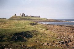
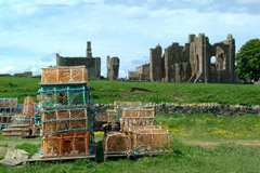
Berwick has changed hands several times throughout history. For a period of 300 and more years from the mid 11th century the town was an extremely important strategic asset in the wars between England and Scotland. The architecture of the town reflects its past, in particular in having one of the finest remaining defensive ramparts (of 1555, though much repaired in the late 18th century), and in the Barracks buildings, begun in 1717 and the first such buildings in Britain. Nikolaus Pevsner writes that Berwick is one of the most exciting towns in the country, with scarcely an irritating building anywhere, and the most intricate changes of level.

Today the Barracks is maintained by English Heritage and is the regimental home of the Kings Own Scottish Borderers. The town is also the lowest bridging point of the River Tweed, an important salmon fishery on the England-Scotland border.

The Old Bridge, a 15-span sandstone arch bridge measuring 1,164 feet in length, was built between 1610 and 1624. The bridge continues to serve road traffic, in one direction only. The current structure is a Grade I listed. Four previous bridges stood on the site, with two destroyed by flooding (in 1199, the original, and in 1294, the third), one by an English attack in 1216 and the last, built 1376, served until James I of England ordered the construction of the present bridge. It was then on the main road from Edinburgh to London, and the king (who was also James VI of Scotland) had had to cross over the then dilapadated wooden bridge in 1603 while travelling to London for his coronation.

The Royal Border Bridge, designed and built under the supervision of Robert Stephenson between 1847 at a cost of £253,000, is a 720-yard-long railway viaduct with 28 arches, carrying the East Coast Main Line 126 feet above the River Tweed. It was opened by Queen Victoria in 1850.

The Royal Tweed Bridge, built in 1925 and in its time having the longest concrete span in the country at 361 feet, was originally designed to carry the A1 road across the Tweed; the town now has a road bypass to the west. In the early 2000s, its fabric was renovated, the road and pavement layout amended, and new street lighting was added. Construction work was undertaken by L G Mouchel & Partners, who still operate today (as Mouchel Parkman). The design is of reinforced concrete and consists of four unequal arches.

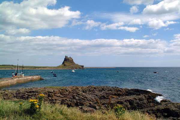
The Union Bridge (five miles upstream), the world's oldest surviving suspension bridge. When it opened in 1820 it was the longest wrought iron suspension bridge in the world with a span of 137 metres (449 ft), and the first vehicular bridge of its type in Britain. Although work started on the Menai Suspension Bridge first, Union Bridge was completed earlier. Today it is the oldest suspension bridge still carrying road traffic.

Another quirky part of town's history is the Berwick Parish Church, unique for having been built during the Commonwealth of Oliver Cromwell. The building, constructed around 1650 using stone from the 13th century Castle (parts of which still stand by the railway station), began as a plain preaching box, with no steeple, stained glass or other decorations. Much altered with a conventional interior layout, contents include a pulpit thought to have been built for John Knox during his stay the town.

It is unique for an English town in that its football team, Berwick Rangers, plays its matches in the Scottish Football League; owing to the south-west to north-east direction of the border, it is located further north than several Scottish league clubs including Gretna, Queen of the South (Dumfries), Stranraer, Ayr United and Kilmarnock.

If you are interested in history, architecture and like the fresh sea breeze Berwick is an ideal place to visit.

Article adapted from the Wikipedia online encyclopedia.

How to get to Berwick:
By road: Berwick is conveniently located just off the main A1 road. It is about 60 miles north of Newcastle upon Tyne and 90 miles south of Edinburgh.
By rail: The nearest station is Berwick upon Tweed. The station is on the main east coast railway line and is served frequently by trains from London and Newcastle upon Tyne in the south and Edinburgh in the north.
By bus: Arriva Northumbria services 501 and 505 (525 on Sundays and Bank Holidays) runs from Newcastle upon Tyne via Morpeth, Alnwick, the North-Northumberland coast up to Berwick. Travelsure service 23 links Kelso in the Scottish Borders and Berwick. Perrymans service 253 links Edinburgh and Berwick.

Map of area: CLICK HERE

Prudhoe


Prudhoe Castle stands guard over the River Tyne.

Prudhoe is a small town in the southern part of the English county of Northumberland in the district of Tynedale, close to the border with Tyne and Wear and just south of the River Tyne. Prudhoe is officially the largest town in Tynedale with a population of over 11,500. Perched on the steep southern slopes of the Tyne Valley, Prudhoe has for centuries had a strategic role. Prudhoe Castle was erected in the 12th century and overs the river, the town has grown in importance around it. Today, industry plays a major part in Prudhoe's economy. Prudhoe has two large factories - SCA Hygiene (formerly Kimberly-Clark) which makes paper products such as tissues at their Prudhoe Mill factory, and Hammerite Products, an ICI owned factory producing paints for Cuprinol, Hammerite and various brands as well as thinning products. Waterworld, a leisure pool, provides a relaxing which brings a relaxing tropical feel for the townsfolk. The Tyne Riverside Country Park follows the river's edge and a former railway line across a bridge which might be familiar to residents of Sydney and Newcastle.

The gatehouse, curtain wall and keep are all that remain of the castle, which is owned and maintained by English Heritage.

Article adapted from the Wikipedia online encyclopedia.

How to get to Prudhoe:
By road: Prudhoe is conveniently located just off the main A69 road, about 10 miles west of Newcastle upon Tyne.
By rail: The nearest station is Prudhoe. Connecting rail services are available from Carlisle in the west and Newcastle upon Tyne in the east.
By bus: The Carlisle-Newcastle service, route 685, operates via Prudhoe on weekdays. On Sundays service 85 operates hourly from Newcastle Eldon Square to Prudhoe. Services X85 and 185 also operate between Newcastle and Prudhoe but these services are very infrequent. Check bus times before travelling.

Map of area: CLICK HERE

Hexham


River Tyne at Hexham.


Hexham abbey.

Hexham is a large market town in Northumberland, England, located south of the River Tyne. Hexham is the administrative centre for the Tynedale district, although in terms of population, Prudhoe is now Tynedale's largest town. In 2001, it had a population of 11,139.

There are many smaller towns and villages that surround Hexham, such as Corbridge, Riding Mill, Stocksfield, Wylam to the east with Haydon Bridge and Bardon Mill to the west. The closest major city to Hexham is Newcastle upon Tyne and is approximately 25 miles (40 km) to the east.

Hexham originated as a monastery founded by Saint Wilfrid in 674. The crypt of the original monastery survives, and incorporates many stones taken from nearby Roman ruins - probably Corstopitum or Hadrian's Wall. The current Hexham Abbey dates largely from the 11th century onward, but was significantly rebuilt in the 19th century. Other notable buildings in the town include the Moot Hall, the covered market, and the Old Gaol.

The name of Hexham came from Anglo-Saxon Hagustaldeshām = "Hagustald's home" or "the hedge-warden's home", although it is often incorrectly regarded to mean "land or settlement of witches".

Like many towns in the North of England, Hexham suffered from the border wars with the Scots, including attacks from William Wallace who burnt the town in 1297. In 1312, Robert the Bruce, King of Scotland, demanded and received £2000 from the town and monastey in order to be spared a similar fate.

In 1715 the 3rd Earl of Derwentwater raised the standard for the Old Pretender in Hexham Market place, however the rebellion was unsuccessful, and the Earl was captured and beheaded after the battle of Preston.

Hexham was the county town of the former county of Hexhamshire.

Article adapted from the Wikipedia online encyclopedia.

How to get to Hexham:
By road: Hexham is conveniently located just off the main A69 road, about 20 miles west of Newcastle upon Tyne.
By rail: The nearest station is Hexham. Connecting rail services are available from Carlisle in the west and Newcastle upon Tyne in the east.
By bus: The Carlisle-Newcastle service, route 685, operates via Hexham on weekdays. On Sundays service 85 operates hourly from Newcastle Eldon Square to Hexham. Services X85 and 185 also operate between Newcastle and Hexham but these services are very infrequent. Check bus times before travelling.

Map of area: CLICK HERE

Rothbury and Simonside


Climbers enjoy Simonside crag, overlooking sleepy Rothbury below.

Nestled snuggly between the Simonside Hills on the edge of the Northumberland National Park, you'll find the small market town of Rothbury. On the approach to the town you'll find the National Trust's Cragside house and gardens.

Cragside house is set in over 1000 acres of pine-covered hillsides, lakes and tumbling streams. The house, boasting hot and cold running water, central heating, a passenger lift and Turkish bath was a huge feat of civil engineering when it was built back in the 1880's. The house was also the first place in the world to be lit by hydroelectricity.Visitors can go and explore the pumping houses, turbine rooms, hear the grating metal and smell the burning of oil exactly the way it was 130 years ago. The estate has an extensive network of tracks, lakes, streams, ornamental gardens and a visitor centre.

To the south of the town lie the imposing Simonside hills. The hills are a designated special area of conservation and comprise rolling moorland, grassland and conifer woodland. The Forestry Commission maintain much of the land, which is open for walking, mountain biking, horse riding, picnics and general recreation. There are spectacular views up the Coquet Valley to Thropton and further afield.

Article adapted from the Wikipedia online encyclopedia and Rothbury Village website.

How to get to Rothbury:
By road from the south: take the main A1 trunk road from Newcastle upon Tyne. Turn off at Alnwick, which is about 35 miles north of Newcastle on the left and is clearly sign posted. Head for Alnwick town centre and then take the B6341 road to Rothbury.
By road from the north: Take the main A1 trunk road from Edinburgh and Berwick upon Tweed. Turn off at Alnwick, which is about 30 miles south of Berwick on the right and is clearly sign posted. Head for Alnwick town centre and then take the B6341 road to Rothbury.
By rail: The nearest stations are Alnmouth for Alnwick and Morpeth.
By bus: Arriva Northumbria service 416 runs between Morpeth and Thropton calling at Rothbury. Check the timetable before travelling as services are infrequent.

Map of area: CLICK HERE

Alnwick - the lionheart of Northumbria


Alnwick Garden cascade.


Alnwick Garden treehouse.


View of Alnwick Castle from the Lion Bridge.

Alnwick is a small market town in North-Northumberland. It has narrow cobbled streets, friendly locals and is seeped in history. The town also boasts a fine castle surrounded by beautifully landscaped pastures, woodland and moorland. A fairly recent addition to the town is the popular Alnwick Garden. The Alnwick Garden boasts a magnificent tiered cascade and fountains and the largest treehouse in Britain. There is also a well-stocked rose garden and a poison garden comprising some of the most deadly and illegal plants in the country. The garden is a family oriented venue where children can splash around in the fountains, ride around on toy tractors and play games while the adults snooze in the shade or explore the wide array of flora and fauna. The Alnwick Garden is well worth a visit, but I would time it so that you had a good few hours there on a bright sunny day. Admission prices are £8 adult, £7.50 concession and free for up to 4 children accompanying an adult. You get better value for money if you buy a joint castle and garden ticket.

Alnwick Castle itself, the second largest inhabited castle in Britain, has been the seat of the Earls and Dukes of Northumberland since 1309. The present Duke and Duchess are Ralph and Jane Percy. The Duchess was the main driving force behind the Alnwick Garden and still has a very much hands on role. The castle overlooks beautiful grass pastures which many Alnwick locals use for recreation. The castle acted as Hogwarts School of Witchcraft and Wizardry in the recent movies Harry Potter and the Philosopher's Stone and Harry Potter and the Chamber of Secrets. It was also the venue of the first Blackadder series with Rowan Atkinson. Every Shrove Tuesday there is a big football match on the pastures between the town's two parishes of St. Michael's and St. Paul's. Traditionally the Duke throws the ball from the castle barbican before it is marched down the Peth to the sound of pipe music. Most people who have lived in Alnwick all their life are uncertain of the rules of the match, if there even is any! At the end of the match the ball is thrown into the River Aln and the person who retrieves it gets to keep it as a momento.

Hulne Park is another part of the Northumberland Estate. The enclosed park, mainly conifer woodland and rolling moorland, is the ideal venue for walking and offers many scenic views of the coast to the east and snow topped Cheviot Hills to the north. Hulne Priory and Brizlee Tower are also located in the park.

In the town centre you'll find Barter Books, the largest second hand bookshop in the country. The shop is an Aladdin's cave housed in the old station buildings opposite the Tenantry Column (referred to as the Lion Column by locals). As you enter the shop you are greeted by friendly staff and the aroma of freshly brewed coffee and muffins. If you are an avid reader you could easily spend an entire day leafing through the collection, listening to music and relaxing in front of the crackling log fire in the old station waiting room.

Every summer the town hosts the Alnwick International Music Festival and Alnwick Fair. These events are free of charge and are in the Market Place. The music festival tries to offer fresh entertainment each year and, as the name would indicate, has acts from across the globe. The fair is getting a bit stale - it still seems popular with visitors to the town, but is the ideal excuse for local people to book a holiday and get away for the week!

Article adapted from the Wikipedia online encyclopedia.

How to get to Alnwick:
By road from the south: take the main A1 trunk road from Newcastle upon Tyne. Alnwick is about 35 miles on the left and is clearly sign posted.
By road from the north: Take the main A1 trunck road from Edinburgh and Berwick upon Tweed. Alnwick is about 30 miles south of Berwick on the right and is clearly sign posted.
By rail: The nearest station is Alnmouth for Alnwick. Take Arriva Northumbria bus service 518 into Alnwick. Additionally, the Dreadnought Coaches operate a Coastal Clipper service during the summer months.
By bus: Arriva Northumbria services 501/505 (weekdays and Saturdays) and Travelsure service 525 (Sundays and public holidays only) run between Newcastle upon Tyne and Berwick upon Tweed and call at Alnwick.

Map of area: CLICK HERE

The Farne Islands


Grey Seals bask in the sunshine.


Longstone lighthouse - location of Grace Darling's famous rescue.

If you head towards the North-Northumberland coastal villages of Seahouses and Bamburgh, you can't help but notice the imposing cliffs of Inner Farne jutting from the sea in the distance. Inner Farne is the most prominant of about 20 islands depending on the state of the tide.

Perhaps the most famous island is Longstone, because of the distinctive red and white striped lighthouse - a favourite on local postcards. The lighthouse was also the home of Grace Darling, a young girl who heroically helped her father, the lighthouse keeper, row across perillously high seas to rescue stranded sailors.

In the early hours of September 7, 1838, Grace, looking from an upstairs window of her family's current lighthouse on the Farne Islands, spotted the ship, Forfarshire, which had run aground on the Harcar Rocks only a few hundreds of yards away. Knowing that the weather was too rough for the lifeboat to put out from the shore, Grace and her father took a rowing boat across to the other island and rescued nine frightened survivors, bringing them safely back to the lighthouse.

Even in her lifetime, Grace's achievement was celebrated, and she received a large financial reward in addition to the plaudits of the nation. She died of tuberculosis, unmarried, in 1842, and her memorial may be seen in the parish church at Bamburgh, close to a museum dedicated to her achievements and the seafaring life of the region. Her deed was committed to verse by Wordsworth and a lifeboat with her name was presented to Holy Island.

The Farnes today are well known for their wide variety of sea life and birds. Frequent pleasure boats take tourists around the islands to admire the Grey Seals, Puffins, Cormorants, Kittiwakes and Terns. The sheltered coves and numerous wrecks around the islands also make them a popular venue for divers.

They are definitely worth a trip. Start in Seahouses in the early morning and catch one of the many boat trips out there. A trip lasts about 2 hours. Try and get a landing on Inner Farne, Longstone or Staple Island and you can admire the spectacular scenery and varied plant, bird and aquatic life for yourself. Once you arrive back on dry land take the pleasant five minute drive to Bamburgh and visit the castle, Grace Darling museum and memorial.

Article adapted from the Wikipedia online encyclopedia.

How to get to the Farne Islands:
By road from the south: take the main A1 trunk road from Newcastle upon Tyne. About 40 miles north of Newcastle you will pass the small hamelet of Brownieside on the left. Take the next right after Brownieside and follow signs for Beadnell and Seahouses.
By road from the north: Take the main A1 trunck road from Edinburgh and Berwick upon Tweed. About 15 miles south of Berwick you will come to Belford, with it's distinctive grain silos on the left. Turn left at the junction next to the silos and follow signs for Bamburgh and Seahouses.
By rail: The nearest station is Chathill, but the services there are very infrequent. Your best bet is to get a train to Alnmouth for Alnwick station and take the local 518 bus service to Alnwick, before catching the connecting 501 bus service to Seahouses.
By bus: Arriva Northumbria service 501 runs between Newcastle upon Tyne and Berwick upon Tweed and passes through Seahouses.

Map of area: CLICK HERE

The Northumberland National Park


The Coquet Valley in the Cheviot foothills.

One of Northumberland's best attractions is the beautiful rolling hills and moorland of the National Park. The park, covering some 1030 square kilometers, lies to the west of the county and is edged by the remote Cheviot Hills to the north and Hadrians Wall to the south. Kielder Forest, one of the largest conifer plantations in Europe, provides one of the final few homes to Britain's native red squirrel. The squirrel, which lives in both broadleaf and conifer woodlands, is practically extinct in other parts of Britain due to competition with the larger North American grey squirrel. Kielder Water, a vast man-made reservoir at the start of the River North Tyne, provides the ideal venue for water skiing, sailing and angling. The forest around the reservoir is cris-crossed with trails and picnic sites for leisurely afternoon strolls.


Article based on Wikipedia and Northumberland National Park websites.