BBC Tyne Regional Latest

Culture: The Stottie Cake


Traditionalists and historians will argue over whether the stottie cake is a Northumbrian or Tyneside invention, but one thing's for sure - it has graced many a Northumbrian packed lunch.

The Stottie cake (or stotty) is a type of bread produced in the North East of England. It is a thick, flat, round loaf (usually about 30 cm in diameter by 8 cm deep). A proper stottie is a meal in its own right.

Stotties tend to be eaten split and filled. Common fillings include ham and pease pudding, but also bacon, egg and sausage. The heavy texture of the bread gives it its name (to 'stott' is Geordie dialect meaning 'to bounce'), and also makes it difficult for many people to eat one whole in one sitting, therefore most bakeries provide them halved or even quartered.

Elsewhere in the world, bread similar to the Stottie is known as Oven Bottom Bread.

Article adapted from the Wikipedia online encyclopedia.

Culture: The Lindisfarne Gospels

The Lindisfarne Gospels.

The Lindisfarne Gospels is an illuminated Latin manuscript of the gospels of Matthew, Mark, Luke and John. The manuscript was produced on Lindisfarne in Northumbria in the late 7th century or early 8th century, and is generally regarded as the finest example of the kingdom's unique style of religious art, a style that combined Anglo-Saxon and Celtic themes, what is now called Hiberno-Saxon art.

The Lindisfarne Gospels are presumed to be the work of a monk named Eadfrith, who became Bishop of Lindisfarne in 698 and died in 721. Current scholarship indicates a date around 715, and it is believed they were produced in honour of St. Cuthbert. The Gospels are richly illustrated in the insular style, and were originally encased in a fine leather binding covered with jewels and metals made by Billfrith the Anchorite in the 8th century. During the Viking raids on Lindisfarne, however, this cover was lost, and a replacement made in 1852. The text is written in insular script.

In the 10th century an Old English translation of the Gospels was made: a word-for-word gloss inserted between the lines of the Latin text by Aldred, Provost of Chester-le-Street. This is the first translation of the Gospels into the English language.

The Gospels were taken from Durham Cathedral during the dissolution of the monasteries, ordered by Henry VIII, and were acquired in the early 17th century by Sir Robert Cotton from Robert Bowyer, Clerk of the Parliaments. Cotton's library came to the British Museum in the 18th century, and from there to the British Library in London.

A campaign exists to have the gospels brought back to Durham Cathedral in the North East of England, a move vigorously opposed by the British Library. A modern facsimile copy of the Gospels is now housed in the Cathedral Treasury at Durham, which can be seen by visitors.

Article adapted from the Wikipedia online encyclopedia.

Alnmouth

Church Hill, seperated from the
village by the great storm of 1806.

Alnmouth is a small fishing and tourist village on the north Northumberland coast. It's about 4 miles south east of the town of Alnwick and lies at the mouth of the River Aln.

The village has been an important trading port in Northumberland's past, mainly involved in the export of grain, and smuggling. The port declined after the river changed course in 1806. This incident also resulted in the original church being cut off from the rest of the village.

The village was in 1860 selected as one of fourteen weather stations, and equipped with barometer by the Duke of Northumberland acting as president of the Royal National Lifeboat Institution. The barometer and a chart of recent readings was kept on public display, to seek to provide fishermen with indications of likely weather patterns so as to assist in diminishing losses at sea. The barometer remains on display, in the window of a cottage facing on the the main street, to this day.

Today, Alnmouth is a popular tourist resort, served by Alnmouth railway station which is situated in Bilton, a mile outside Alnmouth. The narrow streets are home to candy-coloured houses (just like kid's TV programme Balamory). The village has a good range of pubs and hotels and is the ideal base to tour the rest of the county.

Article adapted from the Wikipedia online encyclopedia.

How to get to Alnmouth:
By road: Take the main A1 trunk road north from Newcastle upon Tyne, to Alnwick. Take the Alnwick exit and follow the road towards Alnwick town centre. From the town centre take the A1068 coastal route. Alnmouth is about 4 miles south east of Alnwick.
By rail: The nearest station is Alnmouth.
By bus: Arriva Northumbria service 518 goes from the Haymarket Bus Station in Newcastle via Morpeth to Alnmouth. In the reverse direction, the 518 goes from Alnwick via the coast to Alnmouth. During the summer months the Coastal Clipper service runs between Bamburgh and Amble, via Alnmouth.

Map of area: CLICK HERE


Blyth

Blyth is a nuclear-free zone - perhaps its only redeeming feature.

I'm scraping the barrel once again in my whistle-stop tour of (arguably) England's most beautiful county. This time we're at Blyth - home of not-so-golden beaches, pollution, crime and unemployment. Kind of like Ashington, but slightly less glamorous and easy on the sinuses. On a positive note it does have some 'canny' people (as we say around these parts), innovative technology on Kitty Brewster industrial estate, loads of cheap continental retail outlets (you know the ones) and the wind turbines are making a positive contribution in the fight against global warming. Rumour has it you could once catch fish in the harbour but now you only get supermarket trolleys and burnt-out cars. The local Labour MP is Ronnie 'the Monkey' Campbell - so called because he was too stupid to complete his own time sheets down the pit. Blank out the vision that he is now stalking the corridors of power. He's also not a man to mess with arguing over a kebab (allegedly). As Ronnie would tell you, if he could string a coherent sentence together, despite it's limitations Blyth is still a good place to get a decent bag of chips.

The Earls of Derwentwater owned Blyth and the surrounding land up until 1716, when the third and final Earl was executed after the 1715 Jacobite rising. In 1723, the land was bought by Matthew White and his brother-in-law Richard Ridley, with accumulated fortunes from town-based trades. By 1730, Matthew White extended his landed possessions by purchasing Blagdon, which still remains the seat of his descendants.

The port of Blyth dates from the 12th century, but the modern town of Blyth only developed in the 18th century, with the erection of a quay for the shipment of coal. There were also fourteen salt pans with an annual production of over one thousand tons. The industry closed in 1876 with the destruction of the last saltpan.

Nevertheless, the port continued to prosper. By 1853, the Blyth Harbour and Dock Company was formed, and five years later, the harbour was dredged, allowing a substantial increase in the coal trade: increasing from 250,000 tons of coal being exported in 1855, to 3 million tons by 1900.

Shipbuilding records go back to 1748 but only rose to a formidable level after the beginning of the 20th century, when it developed one of the largest shipbuilding yards on the North East coast with five dry docks and four building slipways. During the First and Second World Wars, the Blyth shipyards built many ships for the Royal Navy including the first aircraft carrier, HMS Ark Royal in 1914. The shipyard was closed in 1967.

The fishing industry also played a significant part in Blyth's development with many people engaged in the salmon and herring industries in the months of August and September.

In 1831 there were 246 inhabited houses combined with a total population of 1,769. By 1931 this had risen to 7,218 inhabited houses with a total population of 31,680.

During the Second World War Blyth Harbour was a submarine base.

Blyth has been seriously affected by the running down of the coalmining and shipbuilding industries but the port of Blyth still remains a major industry in the area with the shipment of paper and pulp from Scandinavia for the newspaper industries of England and Scotland. It is also a dormitory town with substantial new housing estates. There are two trading estates in Blyth, namely Cowpen and Kitty Brewster.

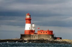
Cambois, just north of Blyth, was the site of a large coal-fired power station. It opened in 1958 and closed in January 2002. The chimneys were demolished on December 7, 2003. Blyth pier (which protects the entrance to the river from the sea) has been home to nine wind turbines since 1992, joined in 2000 by two offshore wind turbines 1km out to sea. At 2MW each, they were when installed the largest in the world.

The town is home to one of England's best-known non-league football clubs, Blyth Spartans.

Article adapted from the Wikipedia online encyclopedia.

How to get to Blyth:
By road from the south: take the main A189 trunk road north from Newcastle. Blyth is about 12 miles north of Newcastle.
By road from the north: Take the main A1 trunk road from Edinburgh and Berwick upon Tweed to Alnwick, about 30 miles south of Berwick. Turn off at Alnwick and take the A1068 coastal route. Just south of Ellington join the A189. Blyth is on the left just after the Ashington turn off. Head for the wind turbines.
By rail: The nearest station is Cramlington.
By bus: Services 42, 43, 101, X1 and EX1 (plus many others) connect Blyth and Newcastle upon Tyne.

Map of area: CLICK HERE

Ford and Etal

Ford Castle, gardens and estate.

Ford is a small village in Northumberland, England, about 13 miles (21 km) from Berwick-upon-Tweed. Ford shares a parish with Etal.

Very little is known of the history of the area before the Norman Conquest in the 11th century, but Bronze Age rock carvings in the area suggest that there might have been some settlement at that time.

It is thought the shallow crossing of the River Till (a ford) which gave the village its name, was probably a crossing place for monks and nuns travelling between the monasteries at Iona and Lindisfarne during the Anglo-Saxon period.

Written records for Ford begin after the Norman Conquest in 1066 and the introduction of the manorial system, when the manor of Ford was held by the Heron family. A substantial stone castle was built at Ford in 1287, in order to protect the Manor from the constant border warfare waged between the Scots and the English during the medieval period.

In 1513, James IV of Scotland made his base at Ford Castle, prior to the Battle of Flodden, the last major battle between the two nations. James was killed, along with 9,000 of his men.

After Flodden, peace came to the area and by the 19th century Ford was a thriving agricultural and forestry community. Ford Castle had been rebuilt in the 1760s and in 1859, Louisa, Marchioness of Beresford inherited Ford Estate on the death of her husband, the 3rd Marquess (who in turn, had inherited it from his mother, Susanna, Marchioness of Waterford). Lady Waterford, a gifted amateur watercolourist with an interest in the welfare of the tenants on the estate, rebuilt the village. A new school was built – today the Lady Waterford Hall, and is decorated with wall paintings by Lady Waterford, and opens daily at 10.30am. The 12th century church of St Michael's was restored.

The estate was bought by the Joicey family in 1907 and it remains in their ownership today. The castle was used as a convalescent hospital by the Red Cross during the Second World War and is now leased by the Northumberland County Council who use it as an educational camp. The castle is not open to the public except on open days.

Much of the employment in Ford is connected in one way or another with the Ford estate. There is St Michael's Church of England First School and a village shop, which doubles as a Post Office. There are also a number of businesses connected with tourism, such as Ford Nurseries, a second-hand book dealer and The Estate House, the local bed and breakfast.

Etal is a small village in the far north of the county of Northumberland, England which shares a parish with nearby Ford. It lies on a bridging point of the River Till ten miles south west of Berwick Upon Tweed, and can boast the substantial ruins of a medieval castle currently owned by English Heritage. It has just one residential street, and has a population of less than one hundred.

The village is centred on a now ruined castle, which over the years has seen much conflict between England and Scotland. The large majority of the buildings in the village are traditional and are owned by Ford & Etal estates. Also there is a thatched pub (The Black Bull) and nextdoor is the village hall. Hiding discreetly behind the Lavender Tearooms and a few more picture postcard houses is an expansive walled garden. Used extensively by the late Lady Joicey for the training of dressage horses, it is now used intermitintly for Icelandic Horse events and features a grass oval track.

Article adapted from the Wikipedia online encyclopedia.

How to get to Ford and Etal:
By road from the south: take the main A1 trunk road north and turn left on to the A697. Follow the A697 northwards through Wooler. About 9 miles after Wooler turn right on to the B6353. Ford is about 2 miles east on the B6353.
By road from the north: Take the main A1 trunk road from Edinburgh and Berwick upon Tweed. About 3 miles south of Berwick, just past Scremerston, turn right on to the B6525. About 6 miles further on you will come to Barmoor Lane End, where the B6525 takes a sharp right and then left. Just after the sharp left take the B6353, which is the firt turn on the right.
By rail: The nearest station is Berwick upon Tweed.
By bus: There are no regular bus services to Ford and Etal.

Map of area: CLICK HERE

Quick Review: ProjectorsCenter.com


For state of the art projector technology
visit Projectors Center.


This post is sponsored by Projectors Center.

In the age of home computing and PowerPoint presentations you might be interested in buying a new projector this Christmas. It's certainly something I've considered - it'd come in very handy for my first aid training, but I know they can be pretty costly to buy and maintain. That's where Projectors Center comes in handy. They have a great range of LCD projectors, DLP projectors, SVGA projectors and consumables at an affordable price. Bizarrely they choose to sell them via an Amazon shop, but that means you're dealing with a familiar and reputable online merchant.

For all your projector needs visit the Projectors Center.

Beadnell

Beadnell - the only west facing
harbour on the east coast.

Beadnell is a village situated about 6 km south east of Bamburgh, on the North Sea coast. Beadnell Bay offers spectacular views of Newton Point and the rugged ruins of Dunstanburgh Castle to the south.

Containing the only west-facing port on the east coast of England, Beadnell is a tourist base, the town being largely comprised of holiday homes, with some small-scale fishing. After many, many lashings by the icy rough sea the harbour is in a state of disrepair and the small pier is barely passable. Two large caravan sites neighbour the village, as well as a handful of campsites.

The Parish Church is the Anglican Church of St. Ebba, built in 1746 and restored in the nineteenth century. A sixteenth century Pele tower remains as part of the public house The Craster Arms

Near the harbour are historic Limekilns, now owned by the National Trust. Beadnell is within the North Northumberland Heritage Coast, and Beadnell Bay, a sandy beach stretching 3 km (1.8 miles) to the south, contains a nationally important colony of Little Tern and the largest mainland colony of Arctic Tern in the United Kingdom. The beach was awarded the Blue flag rural beach award in 2005.

Article adapted from the Wikipedia online encyclopedia.

How to get to Beadnell:
By road from the south: take the main A1 trunk road from Newcastle upon Tyne. About 40 miles north of Newcastle you will pass the small hamelet of Brownieside on the left. Take the next right after Brownieside and follow signs for Beadnell and Seahouses.
By road from the north: Take the main A1 trunk road from Edinburgh and Berwick upon Tweed. About 15 miles south of Berwick you will come to Belford, with it's distinctive grain silos on the left. Turn left at the junction next to the silos and follow signs for Seahouses then Beadnell.
By rail: The nearest station is Chathill, but the services there are very infrequent. Your best bet is to get a train to Alnmouth for Alnwick station and take the local 518 bus service to Alnwick, before catching the connecting 501 bus service to Beadnell.
By bus: Arriva Northumbria service 501 runs between Newcastle upon Tyne and Berwick upon Tweed and passes through Beadnell.

Map of area: CLICK HERE

Culture: The Northumbrian Pipes


The Northumbrian smallpipes (also known as the Northumbrian pipes) are bellows-blown bagpipes from the north-east of England. It shares the unusual characteristic, (along with the Uilleann pipes played on the knee), of being able to play staccato. Here this is done by giving the chanter a completely closed end. This combined with the unusually tight fingering (each note is played by lifting only one finger or opening one key) means that traditional Northumbrian piping is staccato in style. The chanter has a number of metal keys, most commonly seven, but chanters with a two octave range can be made which require seventeen keys, all played with either the right hand thumb or left hand pinkie. There is no overblowing to get this two octave range, due to the cylindrical bore; the keys are therefore integral, along with the length of the chanter, to obtaining the two octaves. The original (18th century) short keyless chanters only had the range of one octave. The introduction of keyed chanters with a range of more than one octave seems to have happened around 1800, with makers such as John Dunn, and later Robert Reid and his son James. In practice, beginning players find that the seven key chanter, with a range of D to b, is sufficient for playing most of the traditional piping repertoire. Chanters with more keys permit playing tunes with a wider range or with more chromatic notes, and allow access to much of the fiddle repertoire.

Traditionally, the chanter has been pitched somewhere between F and F sharp, older instruments often being close to F sharp; this has now been standardised at what Northumbrian pipers refer to as F+, a pitch where the nominal G sounds approximately twenty cents sharp of F natural. This nominal G, however, is always notated as G. Nowadays, chanters are available anywhere from D to G, F+ being the commonest for solo or ensemble piping, but G being the most popular for playing ensemble with other instruments. There are usually four drones on the Northumbrian pipes, which can be tuned to several different combinations of pitch for playing in different keys. Each drone will usually possess one or more 'bead holes' allowing its pitch to be raised by a tone or two. Different drone tunings can be set up, allowing a piper to play in different keys. Sets with five or even six drones are made, to allow ease of retuning. Only three drones are usually sounded at once, tuned for instance to G, D and g if the tonic of the tune is G. Sets with more than four drones sometimes have drone switches, allowing players to change key without stopping playing.

The traditional and basic style of playing on the instrument is to play each note slightly staccato. Each note is only sounded by lifting one finger or operating one key. The aim is to play each note as full length as possible, but still separate from the next - 'The notes should come out like peas'. The chanter is closed, and thus silent, between any two notes. For decoration, it is common to play short grace notes preceding a melody note. Some pipers allow themselves to play these open-fingered, and hence not staccato, and Billy Pigg was able to get great expressive effects in this way - 'You should be able to hear the bairns crying'. But 'choyting', that is the complex open-fingered gracing after the manner of Highland piping, is generally frowned on, and Tom Clough made a point of avoiding open fingered ornament altogether, considering open-fingering 'a grievous error'.

Article adapted from the Wikipedia online encyclopedia.

Craster

Craster harbour.

The Craster fishing fleet.

Craster is a small fishing village on the Northumbrian coast of England. It has a small and attractive harbour and offers a view northwards along the rocky shore to the spectacular ruins of Dunstanburgh Castle. This is the nearest point of access to the castle and the approach must be made on foot as there is just a grassy path. The next village to the north is Embleton.

For many years, the village has had herring-curing business and Craster kippers are well known in England. The local herrings are smoked in a traditional manner by the Robson family.

The remains of a tower on the end of the harbour are all that can be seen now of the much taller building which was part of the overhead equipment which used to convey the local stone from where it was quarried to boats in the harbour. Craster Tower, as it is called, is the home of the Craster family who owned the quarry and had the harbour improved for its benefit. A memorial on the harbour wall commemorates a member of the Craster family who died serving with the British army in Tibet in the 19th century.

The walk along the coast to the south is almost as spectacular as that to the north and passes by Cullernose Point, an example of the basaltic cliffs which are a significant feature of the local landscape.

Article adapted from the Wikipedia online encyclopedia.

How to get to Craster:
By road: Take the main A1 trunk road north from Newcastle upon Tyne, to Alnwick. Take the Alnwick exit and follow the road towards Alnwick town centre. From the town centre take the B1340 towards Seahouses and the coast. Craster is about 6 miles north east of Alnwick.
By rail: The nearest station is Alnmouth.
By bus: Arriva Northumbria service 501 goes from the Haymarket Bus Station in Newcastle via Alnwick to Craster. In the reverse direction, the 501 goes from Berwick via the coast to Craster. During the summer months the Coastal Clipper service runs between Bamburgh and Amble, via Craster.

Map of area: CLICK HERE